Appalachain Trail
The A.T., is the longest hiking-only footpath in the world. The Trail travels along the crests and valleys of the Appalachian Mountain Range from its southern terminus at Springer Mountain in Georgia, to the northern terminus at Katahdin in Maine’s Baxter State Park.
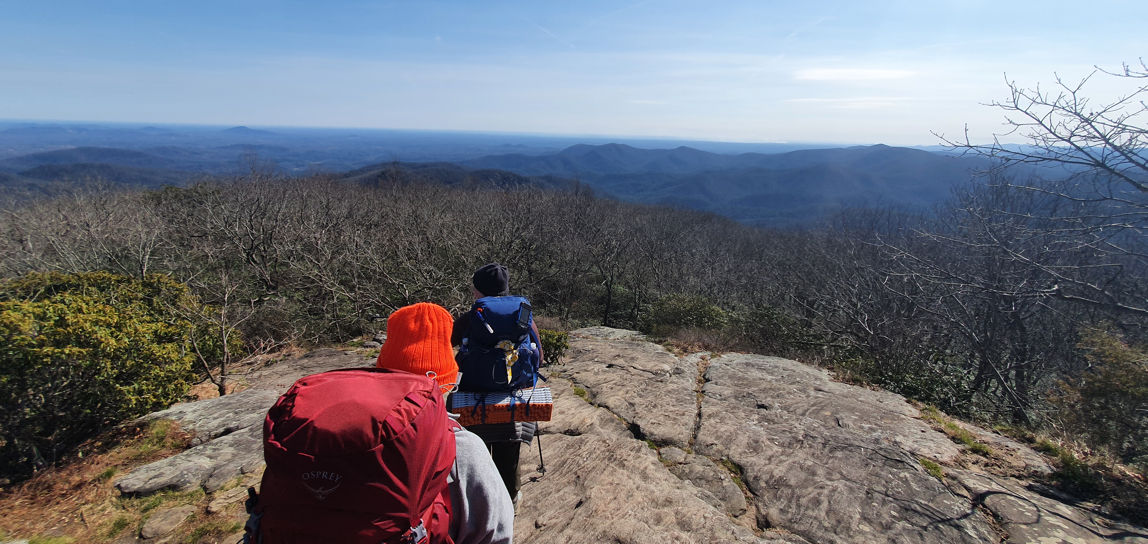
Status: Backpacking, March 2022
Land: USA
Videos
Appalachian Trail Conservancy
The Appalachian Trail (AT) is an approximately 2193.1-mile (3508-kilometer) long hiking trail. It runs from Springer Mountain in Georgia to Mount Katahdin in Maine, passing through 14 states.
Unlike the Pacific Crest Trail (PCT), the AT passes through more towns and roads, making it easier to obtain food and stay in touch with the outside world. Another distinctive feature are the shelters, or lean-tos, which are usually simple, three-sided wooden huts. There is often a fire pit and space for camping nearby. Shelters often have an outhouse nearby.
The highest point on the trail is in the Great Smoky Mountains at 6643 ft (2025m). The AT passes through 17 of the 48 „four-thousanders,“ including Mount Washington, which rises to 6288 ft (1917 m).
Virginia has the longest section of the AT at 550.3 miles (885.6 km), while West Virginia has the shortest at 4 miles (6.4 km).
Maine is home to the most remote section of the Appalachian Trail: the „100-Mile Wilderness.“ It is also home to the only river that must be crossed by boat: the Kennebec River.
The Appalachian Trail is one of the three Triple Crown trails, along with the Pacific Crest Trail (PCT) and the Continental Divide Trail (CDT).
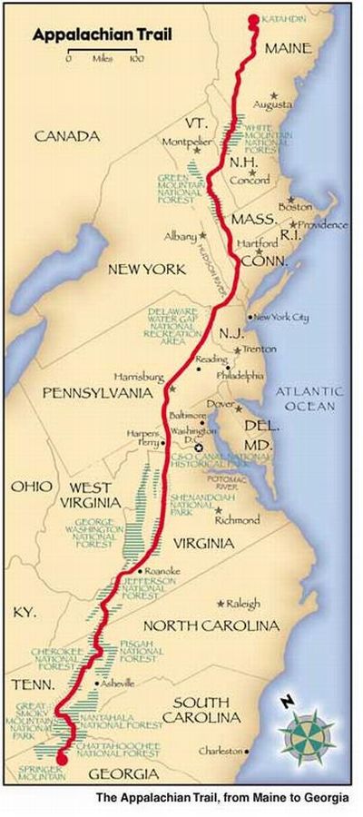
Der Appalachian Trail (AT) ist ein etwa 3508 Kilometer (2193,1 Meilen) langer Wanderweg. Er verläuft von Springer Mountain in Georgia bis zum Mount Katahdin in Maine. Dabei durchquert er 14 Bundesstaaten
Im Gegensatz zum Pacific Crest Trail (PCT) kreuzt der AT vermehrt Ortschaften und Straßen, was die Beschaffung von Verpflegung und den Kontakt zur Außenwelt vereinfacht. Eine weitere Besonderheit sind die Schutzhütten (Shelter oder Lean-to), die meist aus einfachen, dreiseitigen Holzhütten bestehen. In der Nähe befindet sich oft eine Feuerstelle und Platz zum Zelten. Häufig verfügen Shelter auch über ein nahegelegenes Plumpsklo.
Der höchste Punkt des Weges liegt in den Great Smoky Mountains und ist 2.025 m (6.643 ft) hoch. Auf dem AT erreicht man 17 der 48 „Viertausender“, darunter den 1 917 m hohen Mount Washington.
In Virginia liegt mit 885,6 km (550,3 Meilen) der längste und in West Virginia mit nur 6,4 km (4 Meilen) der kürzeste Abschnitt des ATs.
Außerdem liegt in Maine der abgelegenste Teil des Appalachian Trail, die sogenannte „100-Mile Wilderness“, und der einzige Fluss, den man mit dem Boot überqueren muss, der Kennebec River.
Der Wanderweg ist neben dem Pacific Crest Trail (PCT) und dem Continental Divide Trail (CDT) einer der drei Triple-Crown-Wege.